


Tooling
GRED 3D CAD.
GRED HD is available in the following three versions:
– GRED HD BASIC
– GRED HD 3D
– GRED HD 3D CAD
GRED 3D CAD DETAILS.
GRED HD is available in the following four versions:
– GRED HD BASIC
– GRED HD 3D
– GRED HD 3D CAD
GRED HD range is an easy to use post processing software, designed to be the entry level package for all the IDS GPR products.
GRED 3D CAD SPECIFICATION.
GRED HD BASIC offers a 2D viewer and processing with advanced 2D filtering, including: Radarscan viewer; filter and advanced filtering macros; multiple radar scan viewer; Layer picking for automatic analysis of sub-layers; GPS and map track viewer including X, Y and Z axis and digital map importation.
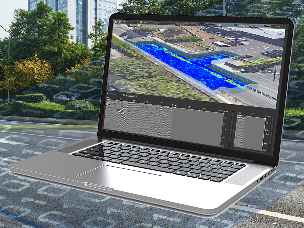
GRED HD 3D is an advanced module which integrates all the features of the basic package and adds 3D viewer features:
Tomographic map view (C-Scan) including radar scan fusion; 3D data visualization; Advanced targeting using Radarscan; tomographic view
GRED HD 3D CAD provides highly interactive and efficient management of large quantities of data. The results can be transferred to CAD (AutoCAD or Microstation) or GIS either by using an interactive link or at the end of the work session; in the latter case, the GEOMAP module automatically generates the final cartographic output.
Additional functions:
CAD, GIS exportation of GPR data and target Synthetic map (only for the Stream family of products)
GRED HD Bridge software is specifically designed to assist the operator in the evaluation of bridge decks, including:
Automatic rebar detection
Damaged area detection
Automatic generation of digital maps (e.g. moisture, asphalt thickness, rebar status maps)
3D tomographic view of rebar meshes
Each ground penetrating radar application has specific requirements, needing dedicated features.